


Description
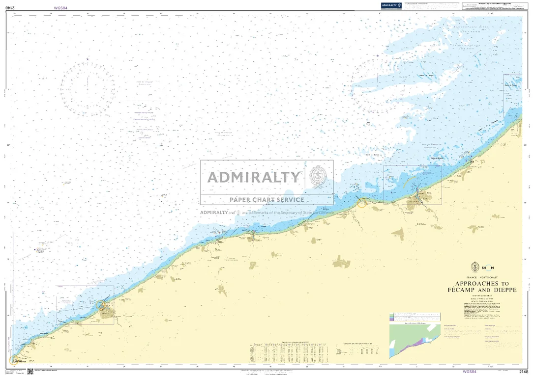
Seekarte UKHO2148 – Approaches to Fecamp and Dieppe
Die amtliche ADMIRALTY-Seekarte UKHO2148 deckt als Küstenkarte das Revier Approaches to Fecamp and Dieppe im Maßstab 1:75.900 ab. Das Kartengebiet liegt im Bereich Ärmelkanal / Frankreich. Abgedeckt werden unter anderem Dieppe und Fécamp. Für die weiträumigere Planung lässt sie sich mit UKHO2451 (Newhaven to Dover and Cap d’Antifer to Cap Gris-Nez) kombinieren.
| Maßstab | 1:75.900 |
|---|---|
| Format | DIN A0 |
| Revier | Ärmelkanal, Frankreich, Haute-Normandie |
| Produktnummer | 26272 |
| Hersteller-Nr. | UKHO2148 |
| Herausgeber | ADMIRALTY (UKHO) |
Amtliche Seekarte nach SOLAS-Standard für die Berufsschifffahrt. Bei HanseNautic im Print-on-Demand-Verfahren mit aktuellem Berichtigungsstand gedruckt, in der Regel am Tag des Bestelleingangs versandfertig. POD-Karten sind vom Umtausch ausgeschlossen.
Reviews
There are no reviews yet.