


Description
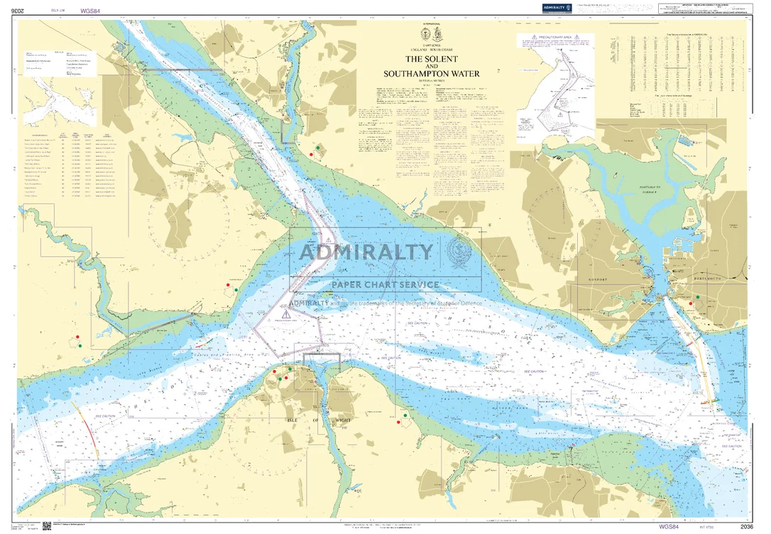
Seekarte UKHO2036 – The Solent and Southampton Water
Die amtliche ADMIRALTY-Seekarte UKHO2036 deckt als Ansteuerungskarte das Revier The Solent and Southampton Water im Maßstab 1:25.000 ab. Das Kartengebiet liegt im Bereich Ärmelkanal / Großbritannien. Zu den abgedeckten Häfen und Ansteuerungen zählen Portsmouth, Gosport, Fareham, Ryde, Cowes und Hythe. Als Küstenkarte unterstützt sie die küstennahe Navigation und die Ansteuerung der Häfen entlang dieses Abschnitts. Für die weiträumigere Planung lässt sie sich mit SC5600 (The Solent and Approaches) kombinieren.
| Maßstab | 1:25.000 |
|---|---|
| Format | DIN A0 |
| Revier | Ärmelkanal, Großbritannien, England |
| Produktnummer | 26197 |
| Hersteller-Nr. | UKHO2036 |
| Internationale Nr. | INT 1730 |
| Herausgeber | ADMIRALTY (UKHO) |
Amtliche Seekarte nach SOLAS-Standard für die Berufsschifffahrt. Bei HanseNautic im Print-on-Demand-Verfahren mit aktuellem Berichtigungsstand gedruckt, in der Regel am Tag des Bestelleingangs versandfertig. POD-Karten sind vom Umtausch ausgeschlossen.
Reviews
There are no reviews yet.